







HOUSTON – As the week progresses, residents can expect an uptick in humidity starting Sunday, with temperatures lingering in the low to mid-90s. However, as rain chances rise midweek, temperatures are forecasted to revert to seasonal averages.
Next week is shaping up to be stormy, as a slow-moving front combines with tropical moisture from the Pacific. This shift in weather patterns is anticipated to lower temperatures into the low to mid-80s. It should be noted that the weather system is complex, and global forecast models are not in agreement regarding the timing of the impending rain.
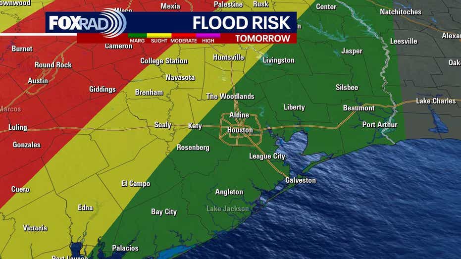
The incoming front is expected to draw in residual moisture from Hurricane Polo, currently active in the Pacific. Rain chances are projected to escalate on Wednesday, with the heaviest precipitation expected on Thursday and Friday. Some regions in Southeast Texas may face a 2/4 risk of flooding on Thursday.
In the Atlantic, Tropical Depression Fay continues to weaken. Meanwhile, an area of disorganized showers and storms east of Bermuda has a 50% probability of developing into a tropical depression by midweek, although it is likely to move away from the U.S.
Turning to the Pacific, there are currently two hurricanes and a new tropical storm. Hurricane Polo is of particular concern for Texans, as it is expected to make landfall in Baja California early this week. The remnants of Polo will move into New Mexico and Texas, creating the potential for heavy rainfall and possible flooding.