







HOUSTON – Tuesday’s weather is expected to bring warmer temperatures compared to the previous day, with the possibility of reaching a record high. Morning fog is less prevalent than it was, although some light drizzles could occur throughout the day.
Areas along the beaches and bays may still experience patchy fog and low clouds as warm, humid air continues to blanket the Houston and Galveston regions. By the afternoon, the temperatures are anticipated to soar, with highs likely surpassing 80 degrees, making it feel quite unseasonably warm for late December.
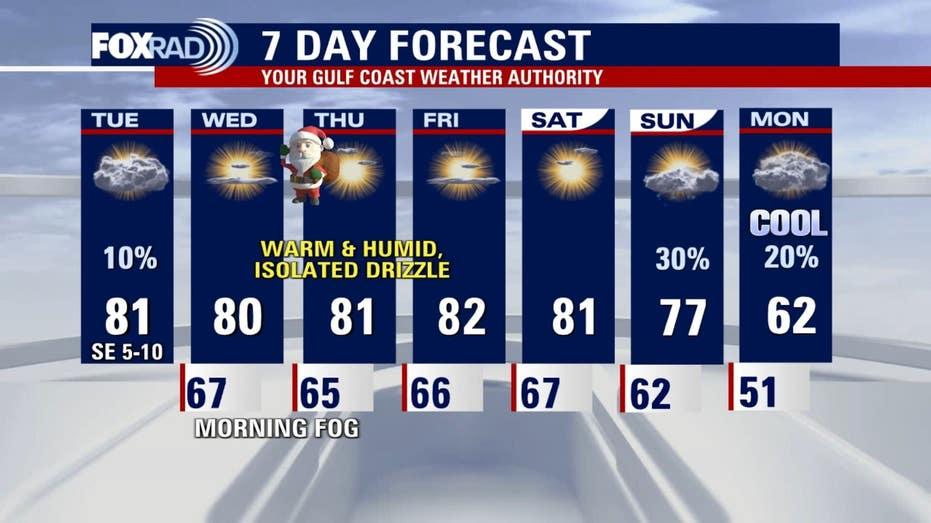
The record high for Houston today stands at 81 degrees, which is at risk of being broken.
The warm weather pattern is set to persist through Christmas Eve and Christmas Day. With gulf breezes and heightened humidity, temperatures are expected to remain significantly above average, contributing to a spring-like ambiance rather than the typical winter chill.
No major weather fronts or widespread rainfall are predicted that could disrupt holiday activities. The primary weather concern will be the morning fog, with daytime highs hovering around 80 degrees.
Looking ahead to New Year’s, there is some uncertainty in the forecasts, but indications suggest a potential shift in weather patterns. Some models indicate that a cooler air mass could move in around New Year’s Eve or New Year’s Day, possibly introducing a more seasonable chill to Southeast Texas for a brief period of about three days.