









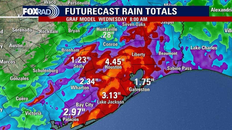
Houston is bracing for a significant weather event as strong storms are predicted for Tuesday evening, extending into early Wednesday morning. The weather forecast indicates potential threats from heavy rainfall, lightning, high winds, and hail. Despite the impending storms, temperatures are expected to reach the upper 80s during the afternoon.
As the day progresses, warm and breezy conditions will prevail, but storm development is anticipated as evening approaches. The Houston area is under alert for scattered thunderstorms that will likely persist into the early hours of Wednesday.
Some of the storms may intensify, bringing gusty winds, frequent lightning, and heavy downpours during the night. The most powerful storms could generate damaging wind gusts and significant rainfall, leading to localized street flooding in areas where storms either stall or pass repeatedly.
The rainy weather pattern is expected to continue, with additional rounds of showers and thunderstorms forecasted through the weekend and into Memorial Day. Although rain will not be continuous, the likelihood of multiple storm waves could result in unsettled conditions persisting through the end of May.