









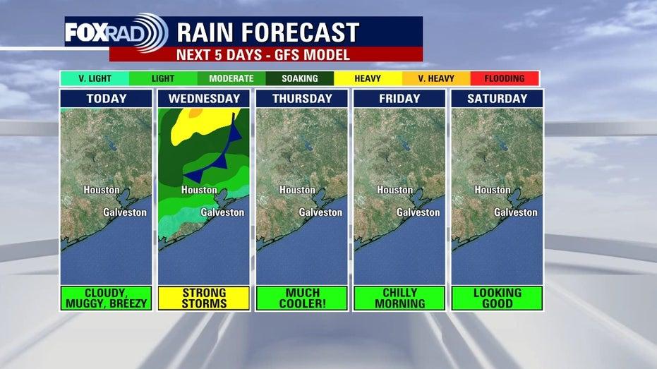
A significant cold front is set to sweep through Southeast Texas on Wednesday afternoon, bringing with it the potential for strong or severe thunderstorms. Residents should be prepared for the possibility of large hail, damaging winds, and even tornadoes, although the most pressing concerns are expected to be damaging wind gusts and locally heavy rainfall.
As the day progresses, the line of storms associated with the cold front is anticipated to become more organized around lunchtime, leading to a clearer timeline for the afternoon’s storm activity. It is advisable for residents to stay informed throughout the day regarding weather developments.
Following the passage of the cold front, Thursday and Friday will usher in noticeably cooler and drier conditions, with nighttime temperatures dropping into the 50s and potentially reaching the 40s by Friday morning. Daytime will feature sunny skies with low humidity and comfortable temperatures, while high temperatures are expected to gradually increase as the weekend approaches.