









Severe weather and flooding risks continue to pose a significant threat across North Texas, particularly east and southeast of the Dallas-Fort Worth area. Scattered storms are expected to persist through Wednesday afternoon, and a wind advisory remains in effect for most of the region. Sustained winds are anticipated to range from 20 to 30 mph, prompting officials to advise caution for drivers of high-profile vehicles. Following a dip in temperatures into the 30s and 40s tonight, a rapid warm-up is forecasted, with temperatures nearing 90 degrees by the weekend.
Showers will continue throughout Wednesday in North Texas, bringing the potential for severe storms and localized flooding. The storms that moved through the area on Tuesday night resulted in some damage and power outages, but the weekend promises sunny skies and unusually warm temperatures.
Wednesday Forecast
Residents of North Texas should remain vigilant as strong storms are still a possibility. Meteorologists are keeping an eye on scattered storms that are expected to develop as a disturbance moves through the region. The risk of severe weather, including damaging winds and large hail, remains particularly pronounced in areas east and southeast of DFW, with heavy rainfall exacerbating the flooding threat.
Conditions are expected to improve as the storm system exits the region by Wednesday afternoon, with showers mainly moving southwest of the Metroplex. The high temperature is projected to reach the mid-60s.
The National Weather Service has issued a wind advisory for most of North Texas, with sustained winds between 20 and 30 mph. Residents are encouraged to secure lightweight outdoor items and exercise caution while driving, especially if operating high-profile vehicles.
Temperatures will drop into the 30s and 40s tonight, accompanied by breezy north winds.
Tuesday Storm Damage
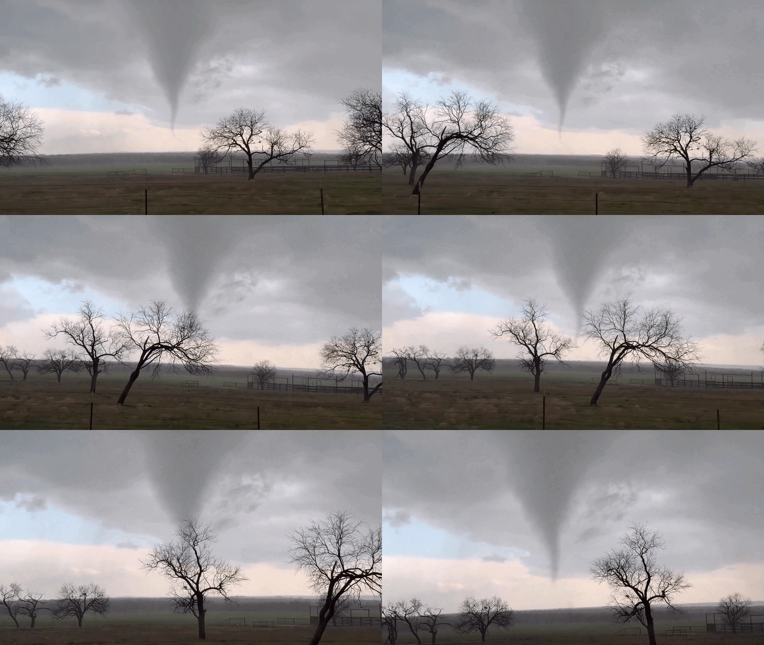
In Taylor County, a storm chaser captured video of a brief tornado that touched down in Potosi, located just south of Abilene, on Tuesday afternoon. Fortunately, there have been no reports of injuries, but crews are currently assessing the damage caused. Additionally, over 4,000 residents in North Texas experienced power outages due to the storms.
If you have experienced the severe weather in North Texas, you are encouraged to share your photos or videos, which may be featured in upcoming newscasts or on social media platforms. Please stay safe.
7-Day Forecast
Looking ahead, Thursday is expected to be sunny and dry, with temperatures remaining in the mid-60s across the area. A significant warm-up is projected as the weekend approaches, with temperatures climbing to the upper 70s and nearing 90 degrees before another cold front arrives on Sunday. This front is expected to bring a slight chance of rain to East Texas and usher in much cooler air for the beginning of next week, with Monday temperatures dropping into the 50s and 60s, leading to a series of chilly mornings and cool afternoons.