





For over 25 years, Texas has consistently revised its state water plan every five years, aiming to anticipate water supply and demand for the next half-century. This proactive approach is intended to alert communities about potential water shortages, allowing them the necessary time to implement solutions.
This foresight is crucial, as water projects can often take years, if not decades, to plan, finance, and construct.
However, the Coastal Bend region, including Corpus Christi, has not received such timely warnings.
The planning process primarily draws from historical droughts, with some regional strategies still referencing the monumental drought of the 1950s, which stands as the longest statewide dry spell on record. Experts now argue that relying on these historical benchmarks is ineffective, given that climate change is resulting in more frequent, prolonged, and severe drought conditions. This raises concerns that past worst-case scenarios may not reflect future realities.
The implications of this approach are significant, as the models used to secure funding and political support for new water projects may be drastically underestimating both the future water demands and the urgency of potential shortages.
“We need to be planning and developing infrastructure for the climate of 2050, the climate of 2100,” stated Benjamin Cook, a climate scientist at Columbia University specializing in North American drought.
The deficiencies in the planning process were starkly highlighted in a recent report by Texas 2036, a nonpartisan think tank focused on the long-term needs of the state. The report revealed that five state water plans developed over 25 years sent mixed signals regarding whether the Coastal Bend could face water shortages in the 2020s.
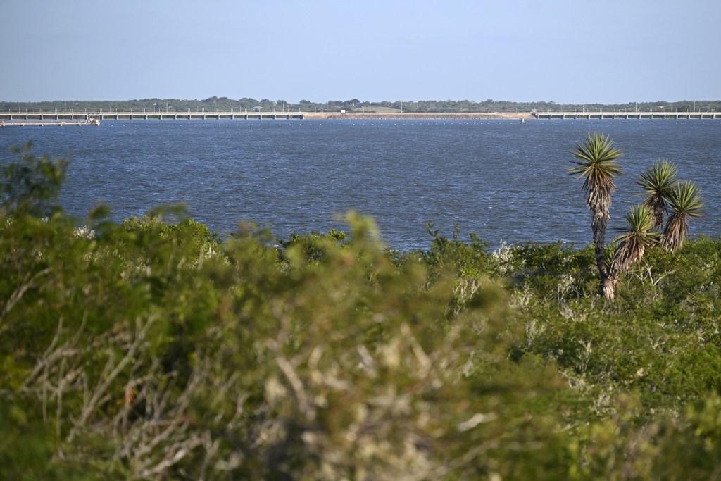
As of October 20, 2025, Lake Corpus Christi was at a mere 11.8% capacity, with only one out of six operational boat ramps available at the state park. Projections yielded both surpluses and deficits, but none clearly indicated the necessity for the Coastal Bend to enhance its water supply—heavily reliant on drought-sensitive rivers and lakes—prior to the onset of the current crisis.
This past spring, prolonged drought conditions threatened to leave Corpus Christi and nearby areas without sufficient water to meet demand, as critical reservoirs dwindled to historical lows. Residents and businesses were urged to conserve water, while industries threatened to relocate. Cities declared disasters, and the governor indicated a potential takeover of water management.
Before summer rains alleviated some of the strain, city officials estimated that by May, they might have to declare a water emergency—an alarming point indicating that supply would fall short of demand within six months.
“That’s a significant oversight in the water plans,” remarked Jeremy Mazur, the director of natural resources and infrastructure policy at Texas 2036 and the report’s author. “What motivation would there have been to prepare for worsening conditions in the 2020s?”
Sarah Kirkle, director of policy and legislative affairs at the Texas Water Association, noted that many state water models fail to incorporate more recent drought data. She emphasized that “worse than the 1950s” does not necessarily equate to the “worst they’ve ever seen locally.”
While a 2023 law enabled regional planning groups to assess scenarios worse than the historical drought of record, it did not allocate funding specifically for the necessary updates to the models underlying these water plans.
Last year, voters approved a $1 billion investment in water projects over the next 20 years, yet none of these funds are designated for updating water supply modeling. Alarmingly, half of the state’s surface water models, which guide decisions on managing river and reservoir supplies, have not been revised since their inception in the 1990s. Updating these models is estimated to cost around $4.7 million.
“To truly be resilient against future droughts, it is essential to consider how climate change affects the vulnerability of our water supplies, and there’s no one-size-fits-all answer to that,” remarked Texas State Climatologist John Nielsen-Gammon.
The Texas Water Development Board (TWDB), responsible for overseeing the state’s water planning process and integrating 16 regional plans into the state plan, adheres to regulations mandating the use of historical drought assumptions. They maintain that these assumptions provide the best available benchmarks for engineers and planners involved in designing reservoirs and pipelines.
While the board acknowledges that existing models may not account for recent or more severe droughts, they do permit groups to utilize more current hydrological data provided by the board for their planning efforts. Kaci Woodrome, the board’s chief communications officer, stated in an email, “It remains challenging to predict the likelihood or conditions of new hydrological droughts that exceed the drought of record, especially at the local water supply level.”
Coastal Bend planners expressed last year that they suspected the region was on the brink of a new drought of record and needed to update their modeling for the 2026 regional water plan. However, they faced insufficient funding while adhering to a state deadline for plan submission.
The state allocated over $637,000 for the Coastal Bend’s 2026 regional plan, but it remains unclear if any of this funding was utilized to enhance the plan’s modeling. Regional planners handling the funding did not respond to multiple inquiries for clarification.
Consequently, this year’s plan is likely to underestimate the region’s future water shortages, according to the Texas 2036 report.
May brought much-needed rain, followed by significant upstream flooding in July, mitigating the immediate threat and postponing the projected water emergency until fall 2028. The combined capacity of Corpus Christi’s two primary reservoirs—Choke Canyon and Lake Corpus Christi—rose from below 8% in April to 42.9% as of this week.
On August 15, 2026, a sign at the Lake Corpus Christi State Park Texas Parks and Wildlife Department station displayed current and recent reservoir levels, reflecting the improvements.
A state legislative interim hearing is set for August 24, where lawmakers are anticipated to discuss regional water planning and propose enhancements to the water planning process.
For Mazur, this year’s near-crisis in Corpus Christi serves as a crucial reminder for state leaders: the current planning process may not provide communities with adequate warnings before their water supplies reach critical levels.
“We cannot base our policies on plans that are flawed,” Mazur emphasized.
The state water plan employs a bottom-up approach, initiated by 16 regional water planning groups that segment the state by river basins and generate plans projecting 50 years into the future.
In the Coastal Bend region, planners were caught off guard when the drought affecting South Texas intensified beyond the benchmark they were using—a regional drought from 2007 to 2013—and found themselves deep into the planning process, racing against a deadline to submit their plan for inclusion in the state’s water strategy.
Restarting the process was not an option.
The Water Development Board adopted the Coastal Bend’s new regional plan in January, despite planners’ concerns that the area was already facing a potentially more severe drought.
Esteban Ramos, Corpus Christi’s water resource manager and a member of the regional planning group, noted that there was insufficient data to analyze the ongoing drought, as such assessments are typically conducted post-drought.
Consequently, the region’s plan was based on modeling from a drought that it now believes has already been surpassed.
Between 1998 and 2004, the state allocated $12.6 million to develop water availability models statewide. While there have been some updates since then, most recently in 2019 for four river basins at a cost of $2.1 million, half of the state’s regions have not updated their models in decades, with the cost to do so projected at $4.7 million.
“Why is it so challenging to update them? Because the state does not invest. Period,” asserted Carlos Rubinstein, who chaired the TWDB from 2013 to 2015.
Rubinstein highlighted that the lack of consistent reinvestment into modeling stems from budget cuts affecting state agencies like the board.
While the state provides regional groups with planning and research grants each cycle, which can contribute to updating models, some planners contend that the available funding is insufficient for timely updates. They also note that reallocating resources to modernize drought models could detract from other essential tasks such as data analysis, forecasting, evaluating water projects, and community outreach.
Kirkle from the Texas Water Association explained that regional groups often operate with limited funds that must support numerous competing priorities, meaning updating models frequently does not take precedence.
The Texas 2036 report found that, across more than two decades of state water planning, the plans failed to provide the Coastal Bend with a clear, timely, and actionable warning regarding the water crisis of the 2020s, despite the system’s intended purpose.
According to Mazur, the state’s main