








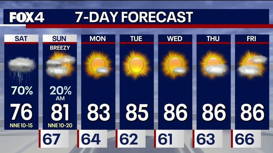
North Texas is bracing for another wave of rainfall this Saturday, which is expected to persist into the early afternoon before gradually diminishing. The most intense precipitation is forecasted for areas south and east of the Dallas-Fort Worth (DFW) region, adding to recent storm totals that have ranged from 1 to 6 inches in certain locations.
The overcast conditions will keep temperatures relatively mild, hovering in the mid-70s during the day. By Saturday night, the likelihood of rain is projected to decrease to approximately 20 percent.
Specific regions, particularly those south and east of Dallas-Fort Worth, may experience localized heavy rainfall, notably in Navarro, Hopkins, Rains, Hunt, and Van Zandt counties. Recent rainfall across North Texas has resulted in totals of 1 to 4 inches in various areas, with some spots near the Red River and to the south and west of DFW reporting accumulations exceeding six inches.
This rainfall has contributed to a promising start for October, which is typically the second-wettest month of the year, positioning it for a potentially above-average performance this year.
On Saturday morning, cloudy skies are anticipated, with temperatures around 70 degrees. As the day progresses, temperatures will rise into the mid-70s, but rain coverage is expected to wane significantly by the evening.