









Temperatures in the Houston area have begun to rise after experiencing several chilly mornings.
Following a frigid Monday morning that recorded a low of 31 degrees, the weather has shifted to a more temperate pattern on Tuesday. The mercury has climbed to the mid-60s under predominantly cloudy skies, aided by returning southeast winds. The influx of warmer air from the Gulf, combined with an approaching disturbance in the jet stream, may bring scattered showers as early as tonight.
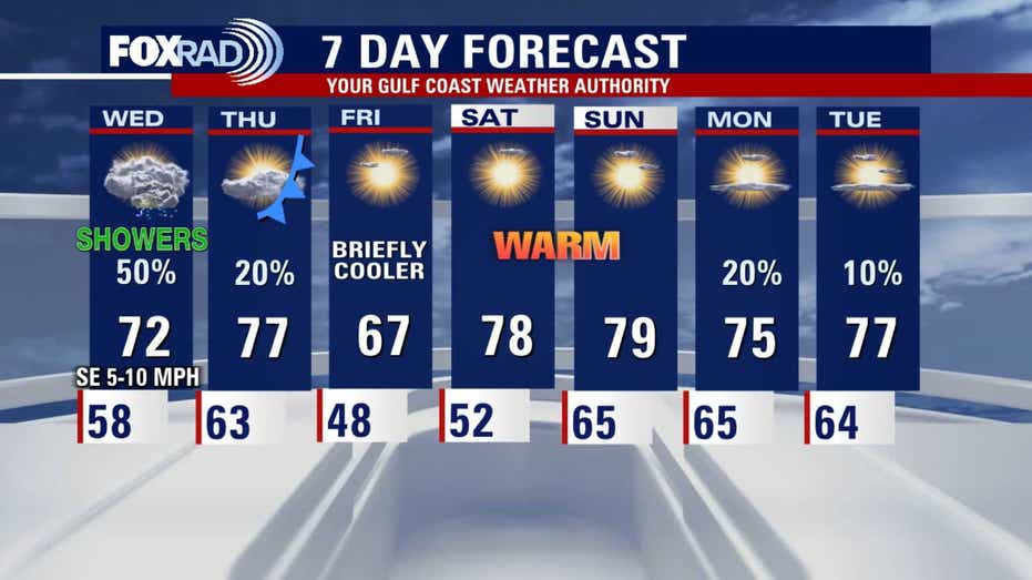
As we move into Wednesday, the moisture in the atmosphere will continue to increase overnight, leading to scattered showers throughout the day. While rain coverage is expected to be inconsistent, there is potential for localized areas of steadier rain and isolated storms as a mild disturbance passes through. Afternoon temperatures are anticipated to remain milder.
The forecast for late in the week suggests a cold front will move through, bringing temperatures back down to seasonal norms and clearing up the weather. Mornings on Friday and Saturday are expected to be brisk, but the weekend is projected to offer comfortable conditions for those who prefer warmer temperatures. Highs could reach the upper 70s, which is approximately 15 degrees above the December average.
Stay tuned for more updates as the weather continues to evolve.