



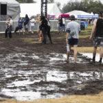






HOUSTON – A stormy weekend is anticipated for the Houston area, prompting the issuance of a Storm Alert from Saturday night into early Sunday morning.
The weather in Southeast Texas will remain warm, humid, and breezy throughout Saturday afternoon, with temperatures reaching the 80s. South winds will blow at 10–20 mph, with gusts potentially higher. While rain chances are low for Friday night activities, showers and storms are expected to increase throughout Saturday, peaking with heavy rainfall late Saturday night.
The Storm Alert will be in effect from late Saturday through the early hours of Sunday, with risks of heavy downpours that may cause localized flooding and the possibility of strong storms.
A cold front is set to move through the area this weekend, which will elevate rain chances on Saturday, particularly with a higher likelihood of widespread storms Saturday night into early Sunday. Forecasts indicate that some areas may experience heavy rainfall exceeding 2–3 inches, leading to the potential for minor flooding, especially after midnight on Saturday into the early morning hours of Sunday. Current model trends suggest that the heaviest rainfall will occur overnight and should taper off by 7 a.m. Sunday.
Following the frontal passage, temperatures are expected to drop into the 70s, accompanied by increased cloud cover and a significant reduction in humidity. Some residual showers may persist into Sunday and early next week, resulting in mostly cloudy skies and below-normal temperatures through Tuesday. A warming trend is expected to return later in the week.