








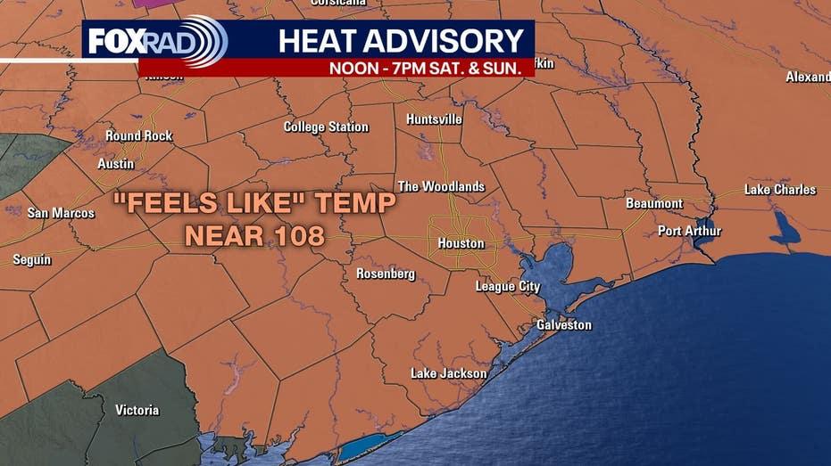
A Heat Advisory has been issued for southeast Texas, effective from noon to 7 PM on both Saturday and Sunday. Expect temperatures to soar into the upper 90s and low 100s, with heat index readings potentially reaching between 106 and 110 degrees.
This weekend will be characterized by extreme heat, with temperatures around or exceeding 100 degrees. While most regions are likely to remain dry, there is a chance of isolated showers or storms developing on Saturday evening, particularly in areas north of I-10.
Currently, the Atlantic remains unusually calm for this time of year, with no immediate tropical threats to Texas. A tropical wave is anticipated to emerge off the coast of Africa, where it may have potential for development as it traverses the Atlantic. However, the likelihood of a brief, weak tropical or subtropical system forming in the northeastern Atlantic in the next few days is minimal, and it is projected to head towards Portugal and Spain, posing no danger to the United States.
Another area of interest near Bermuda is expected to remain distant from the East Coast. Meteorologists will continue to monitor the train of tropical waves in the eastern Atlantic, as activity often increases as we approach the peak of hurricane season in September.