









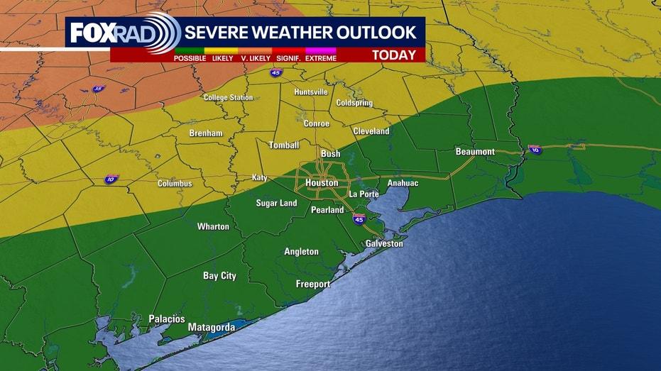
Residents of Southeast Texas are bracing for a series of strong to severe thunderstorms late Sunday night, following a hot and humid Mother’s Day celebration.
On this Mother’s Day, temperatures are soaring, with highs reaching the upper 80s to near 90 degrees. The humidity is making it feel even warmer, with heat indices in the mid-90s. Despite the heat, there is a chance for an isolated storm as the day progresses, so it’s advisable to stay hydrated and enjoy the festivities.
As the night unfolds, a strong line of thunderstorms is expected to enter the region around midnight, with the storms predicted to move offshore by 7 AM Monday. The primary threats from these storms include damaging wind gusts, hail, and heavy rainfall. Areas such as Tomball, Katy, Spring, and Livingston are under a 2/5 risk level for severe weather. While the likelihood of tornadoes is low, it cannot be entirely dismissed, particularly in central Texas.
Residents are urged to remain informed about the evolving weather conditions and to ensure they have access to severe weather alerts, especially as the most intense storms are likely to occur while many are asleep.
Looking ahead to the upcoming week, a more stable weather pattern is anticipated, bringing plenty of sunshine and reduced chances of rain. Temperatures are expected to remain warm, with highs eventually reaching the upper 80s to low 90s.