









The evening forecast for North Texas on Saturday night indicates a calm atmosphere, with only a minimal chance of isolated storms in the far northwestern regions, particularly near Wichita Falls, Graham, and the counties of Jack, Young, and Montague. The Dallas-Fort Worth Metroplex is expected to experience a dry night ahead of Sunday’s weather developments.
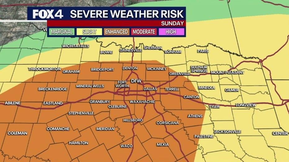
As Mother’s Day approaches, the weather outlook shifts dramatically. The Storm Prediction Center has issued a Level 2 (slight) risk for severe weather across all of North Texas, with the Metroplex facing a heightened Level 3 (enhanced) risk. This indicates a more significant potential for severe weather events.
Storm activity could commence as early as late morning near the Red River, primarily affecting areas north of Highway 380, before intensifying in the afternoon. The critical timeframe for severe weather is anticipated between 3 p.m. and 10 p.m., with the most substantial impacts likely occurring around dinnertime.
The primary threats include damaging winds gusting up to 60–70 mph and large hail, potentially reaching sizes comparable to eggs or larger. Although the risk of tornadoes is low, it is not entirely absent.
Storms are expected to clear by late evening, paving the way for calmer weather on Monday. Some regions, particularly in southern North Texas, may receive over an inch of rainfall.
Residents are advised to remain vigilant and keep track of weather updates through local news sources and weather apps to stay informed of any developments.