








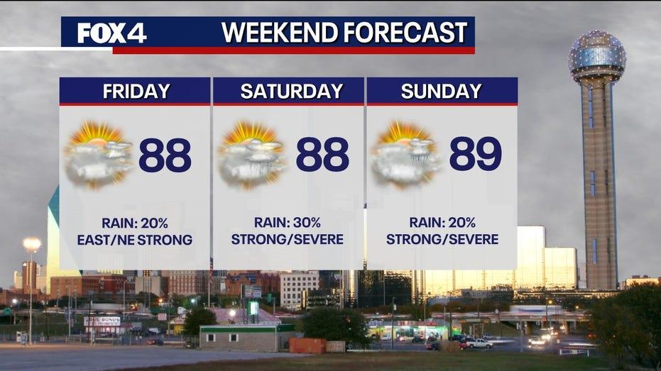
This weekend, Dallas is set to experience a warm and dynamic spring climate, with high temperatures expected to reach between the mid-80s and low 90s. Residents are urged to remain vigilant as the possibility of severe storms looms, particularly in the afternoons and evenings. The primary cause of these storms is a dryline located to the west, which may lead to large hail and strong wind gusts throughout the Metroplex. While some areas may experience dry conditions due to limited storm activity, the active weather pattern is anticipated to persist into the early part of next week.
Watches & Warnings
The National Weather Service has issued a Tornado Watch for several counties, including Rains, Rockwall, Collin, Hunt, Hopkins, Lamar, Delta, Fannin, and Cooke. This watch is in effect until 9 p.m.
A Tornado Warning has specifically been issued for Lamar County, effective until 8:45 p.m.
Friday Forecast
Friday’s weather will begin with mostly cloudy skies, transitioning to clearer conditions by the afternoon. Highs are expected to reach the mid-to-upper 80s. As the evening progresses, storms from Oklahoma are predicted to move southward, with the highest likelihood of severe weather occurring to the east and northeast of the Metroplex. These storms may bring risks of damaging winds and hail.
Evening Forecast Update
Severe weather is a possibility for the northeastern regions of the FOX 4 viewing area. The evening forecast for April 24 will provide additional insights into the expected weather conditions across North Texas.
Weekend Forecast
Throughout the weekend, there is a 20% to 40% chance of severe storms each afternoon and evening. While many areas may remain unaffected, any storms that do develop could pose significant hazards, including large hail and damaging winds. Meteorologists will be closely monitoring the dryline to the west, anticipating a stronger weather disturbance that could trigger storms late Saturday afternoon, moving eastward into the evening. A similar scenario is expected for Sunday, although storm coverage may be reduced.
7-Day Forecast
The active weather pattern is likely to continue into the upcoming week, with low chances of storms remaining in the forecast for Monday and Tuesday. Unseasonably warm temperatures are expected to persist, hovering in the high 80s and low 90s.