








Residents of North Texas are bracing for a heightened flash flood threat over the next 24 hours, as an unusually warm and humid weather system brings a series of heavy rain showers and thunderstorms to an already saturated region.
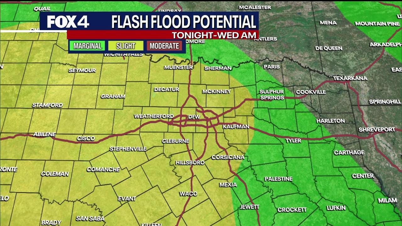
The risk of localized flash flooding is expected to peak late Tuesday night and into Wednesday morning, following a wave of storms that struck on Monday, which produced frequent lightning, heavy downpours, and isolated hail. Areas within the Dallas-Fort Worth Metroplex have already experienced several inches of rainfall in recent days, making any additional precipitation likely to result in rapid runoff.
According to the National Weather Service, isolated showers were detected tracking southwest of the Metroplex on Tuesday morning. However, the day will see a brief respite, with scattered afternoon storms anticipated, covering about 30% of the area. High temperatures are predicted to remain in the mid-80s, aligning with the seasonal average of 87 degrees.
The main weather disturbance is set to arrive from the west on Tuesday evening, intensifying overnight. These rain-producing storms are expected to move eastward, potentially creating hazardous driving conditions and reduced visibility for commuters on Wednesday morning, especially in counties to the east of Dallas.
While the threat of severe weather includes the possibility of isolated high winds and small hail, the main concern remains the heavy rainfall and swift runoff.
The wet weather pattern is anticipated to continue throughout the week, with temperatures remaining in the 80s. Wednesday is expected to be the coolest day of the week, with highs near 80 degrees. Although the widespread flood threat is likely to decrease by Thursday, there remains a 20% to 30% chance of isolated to scattered thunderstorms throughout the weekend.